|
|
|
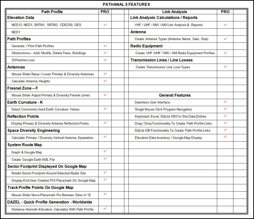
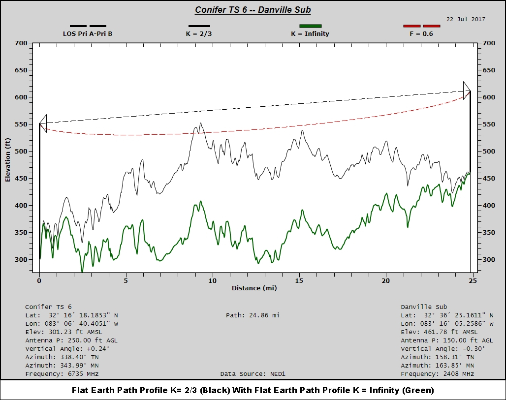
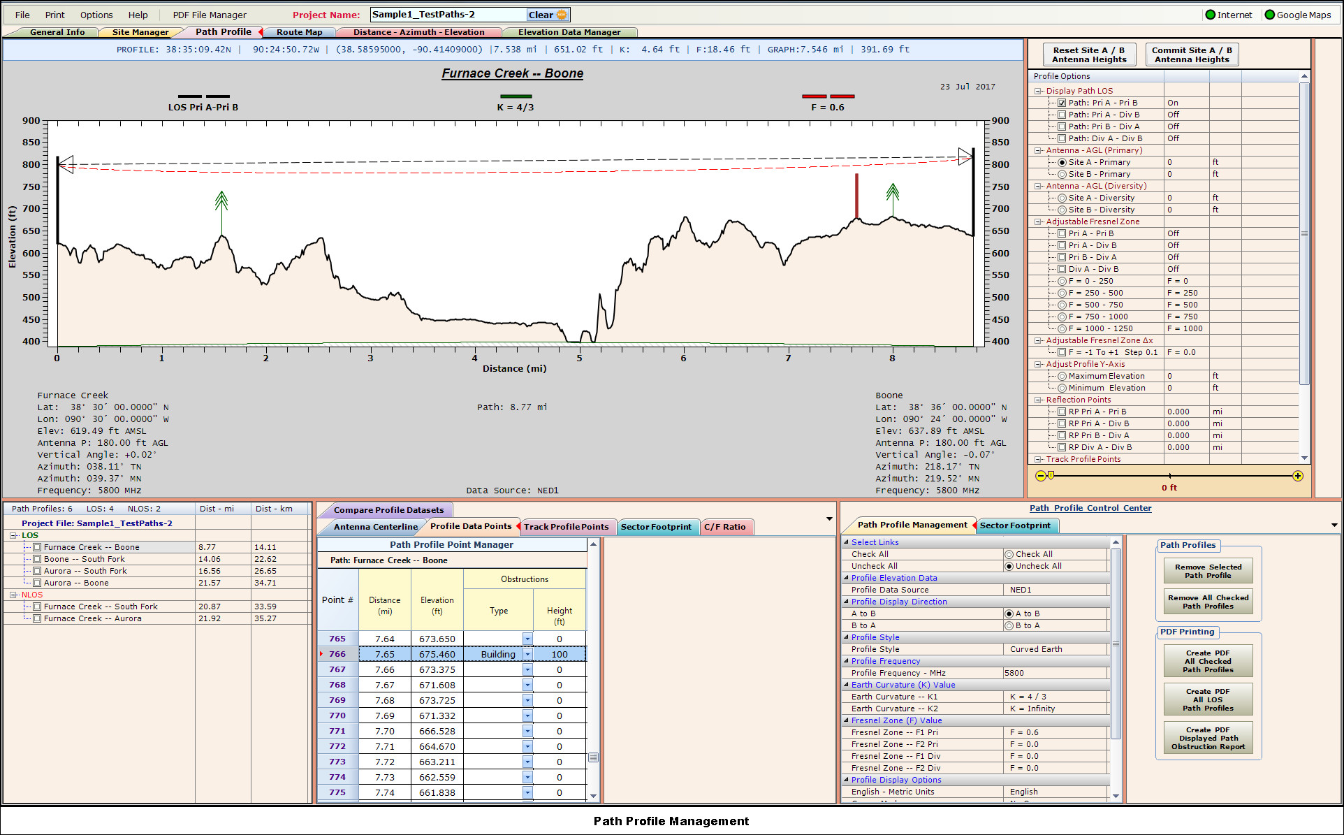
Path ProfilesOffering a variety of styles, path profiles are easy to interpret, contain pertinent site and path information, and are printed to PDF.
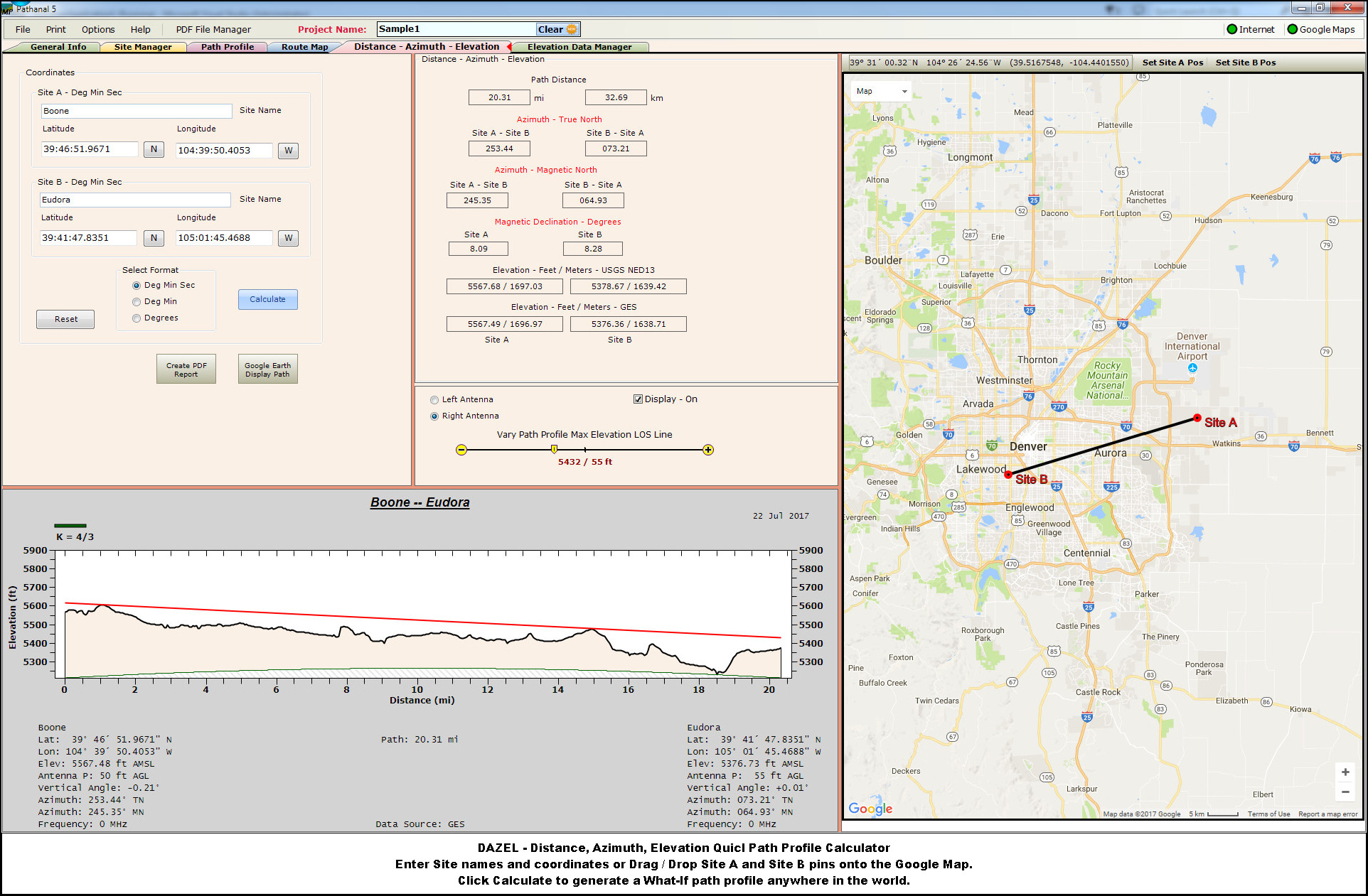
Path profiles can be generated with NED1/13, SRTM1/3, CDED50 (Canada) and Google Elevation Service (GES) data.
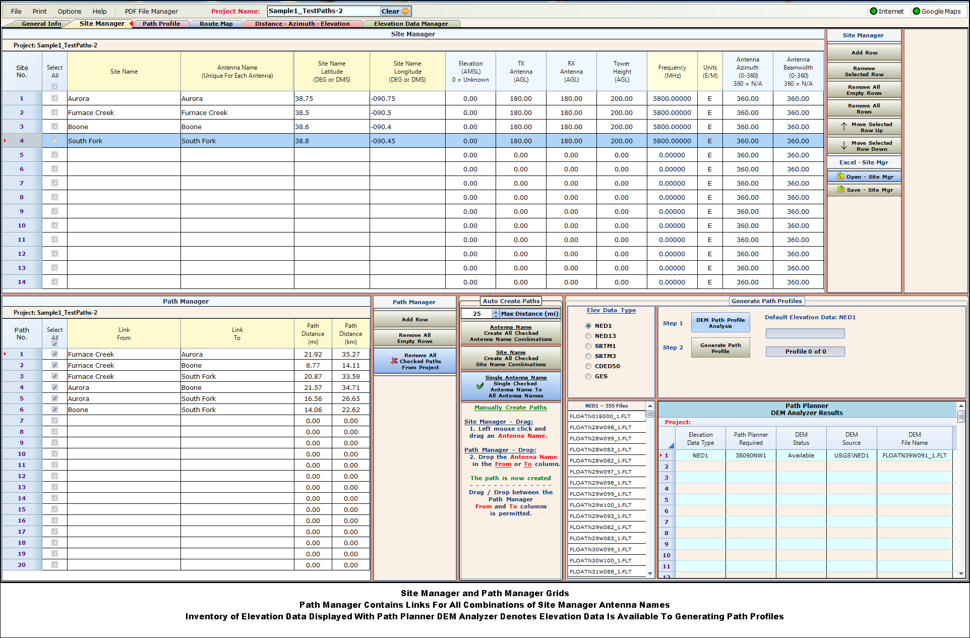
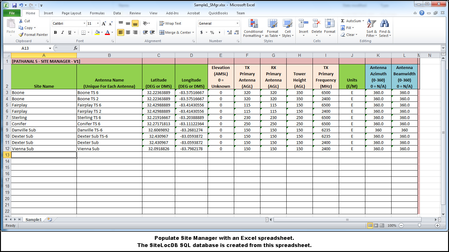
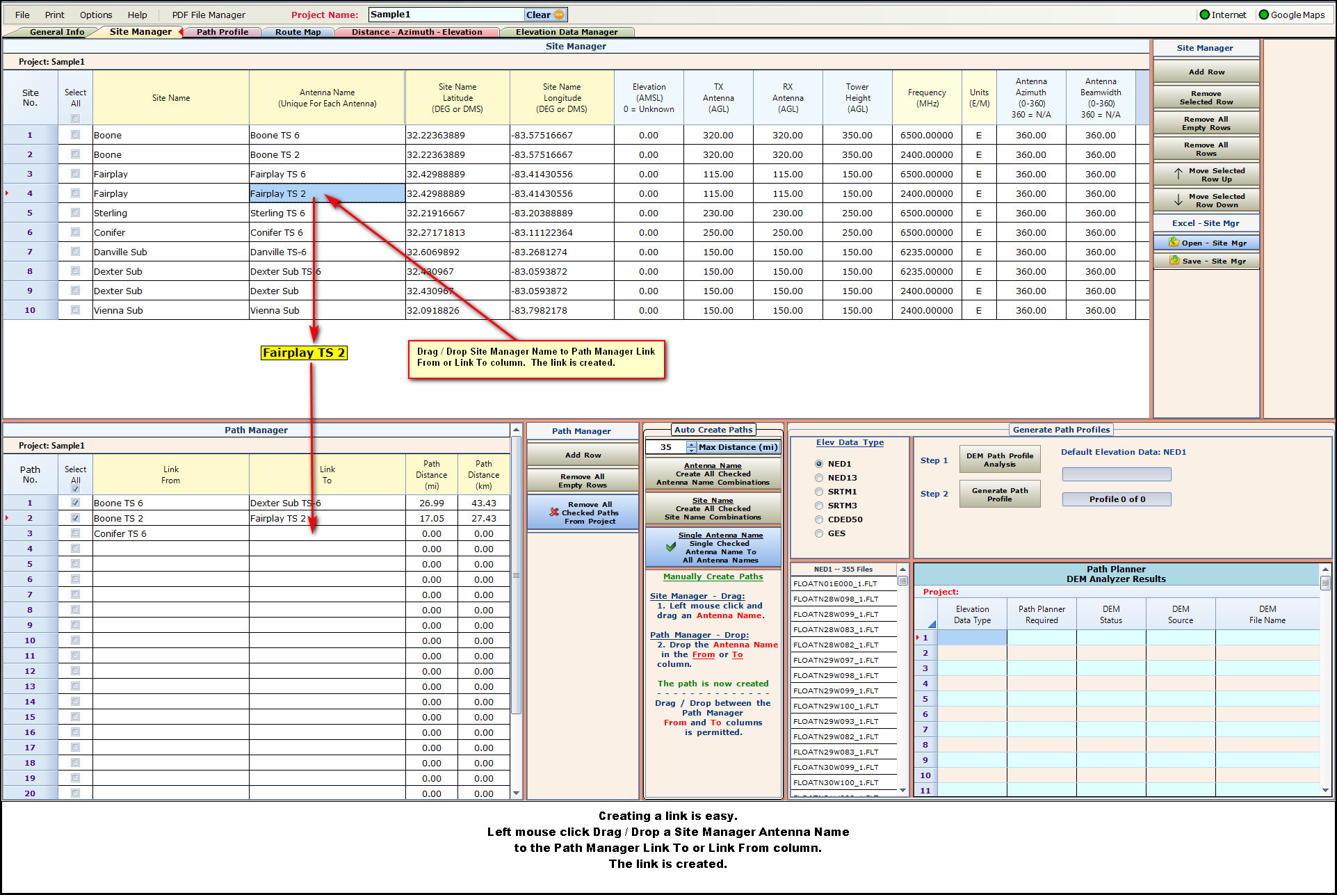
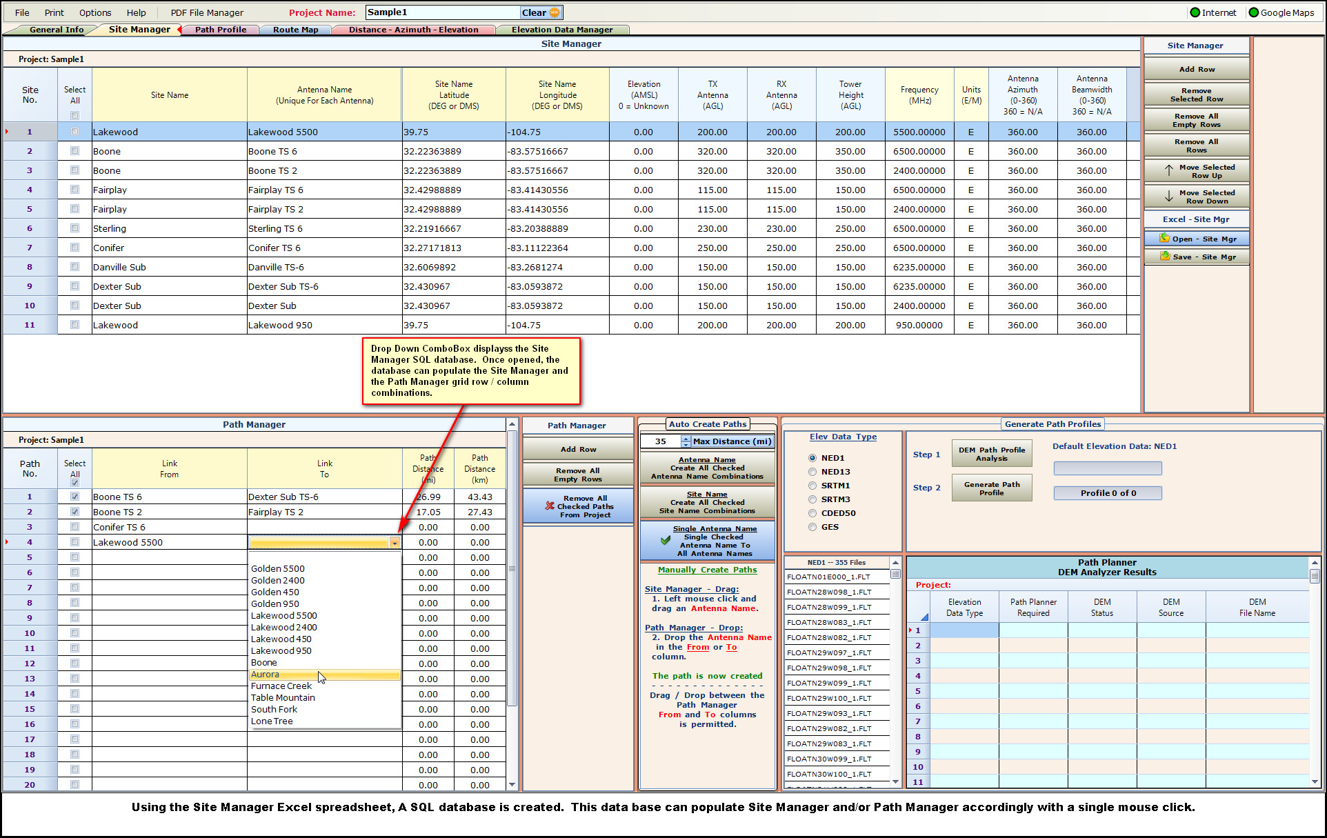
Site Manager - Path ManagerSite Manager contains the site information, Path Manager are the individual links.
Drag / Drop two Site Manager Antenna Names to the Path Manager From / To and the link is created.
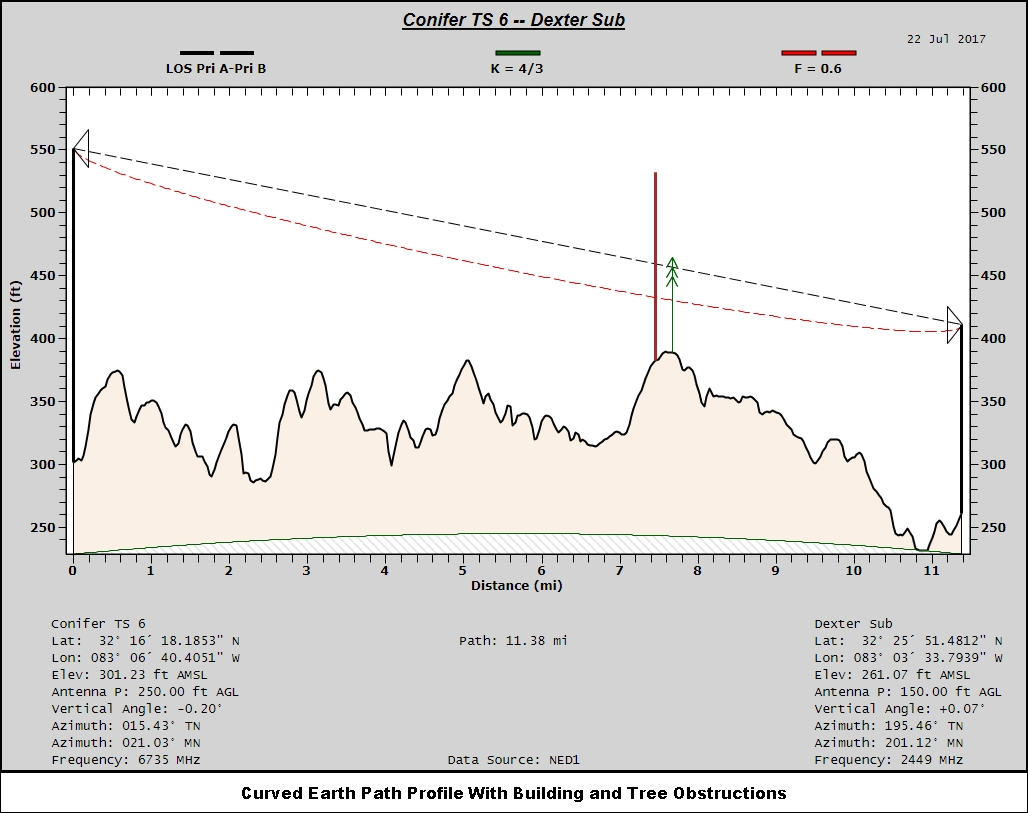
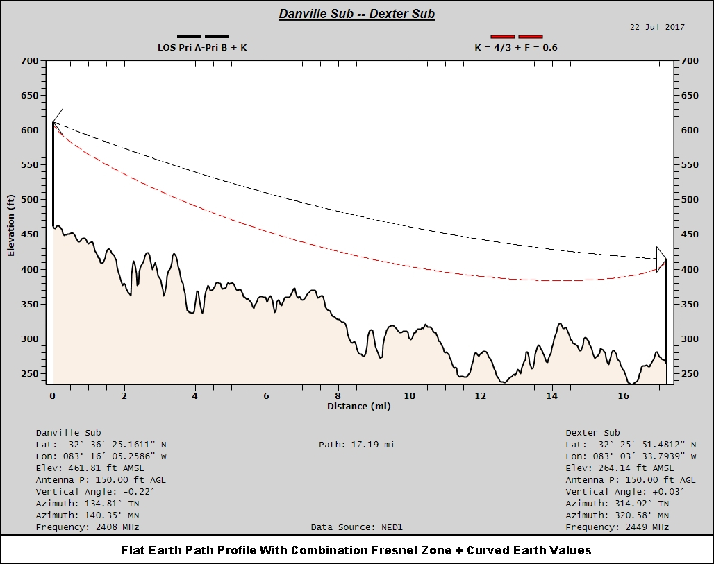
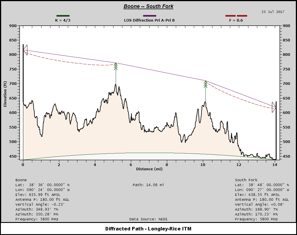
Path Profile ManagementManage path profiles points. Add building or tree obstructions.
Easily manage path profile parameters. With a slider, raise / lower antenna heights, adjustable Fresnel zones, track path profile points, track LOS and Fresnel zone values.
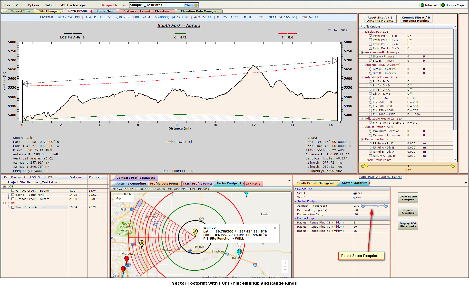
Display and rotate variable beamwidth sector footprints on Google Maps. POI's (Placemark Pins) can also be displayed.
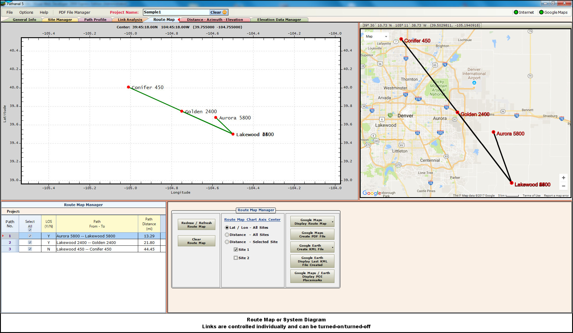
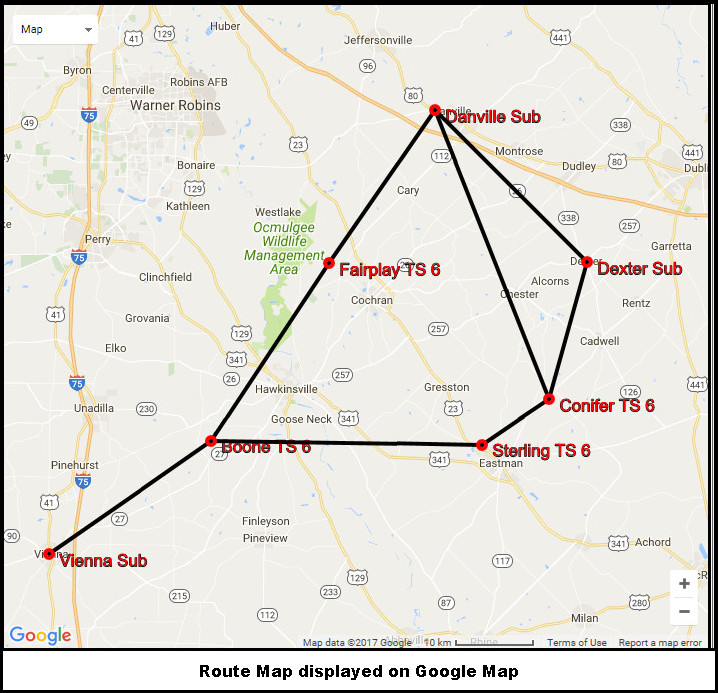
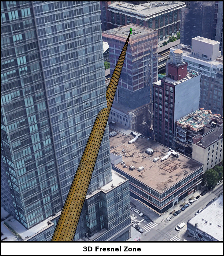
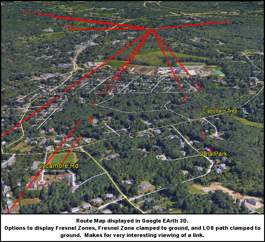
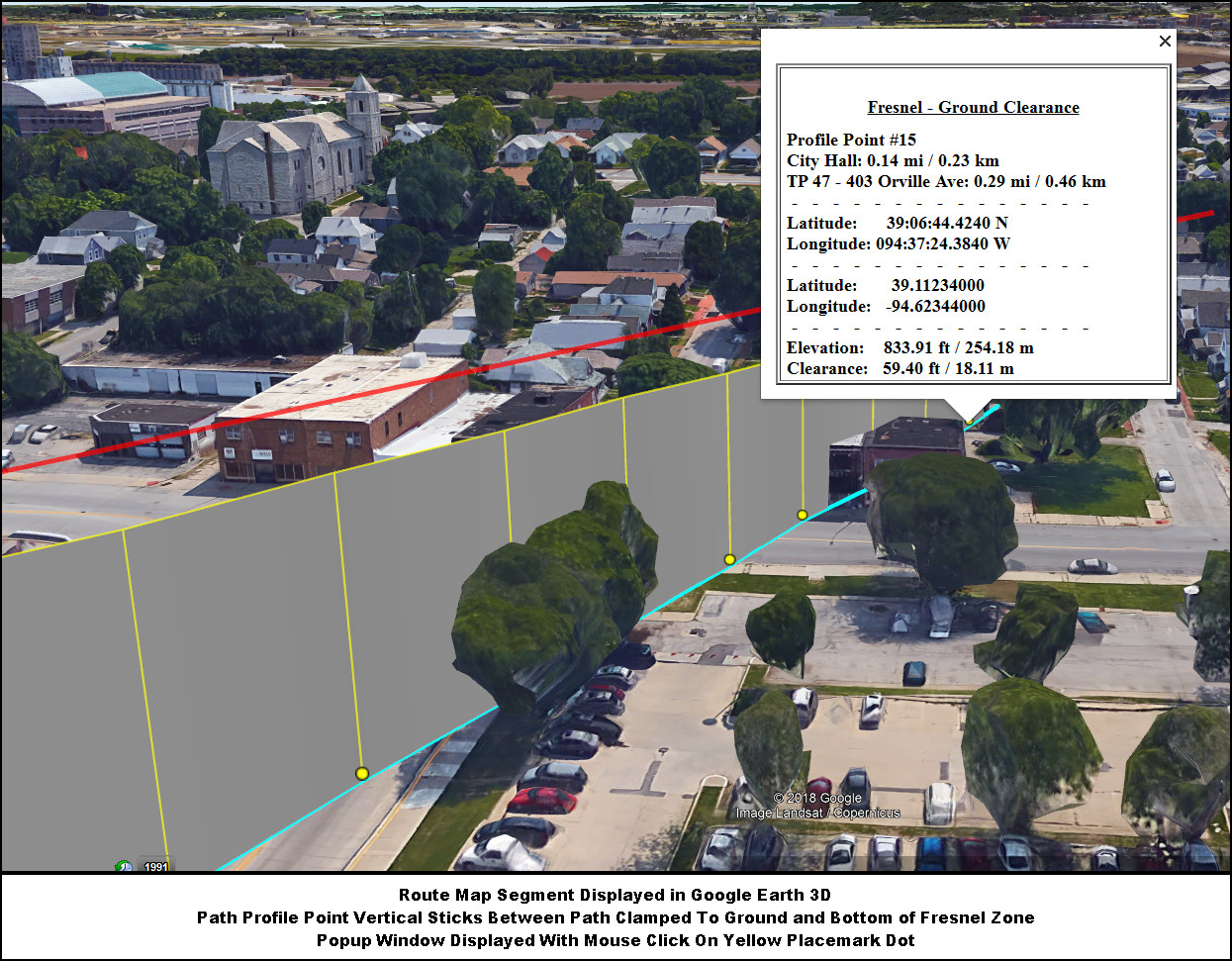
Route Map / System DiagramsRoute Maps displayed on white canvas, Google Maps, and Google Earth. Google Earth options to display Fresnel zone, 3D Fresnel zone, path obstructions, path line clamped to ground.
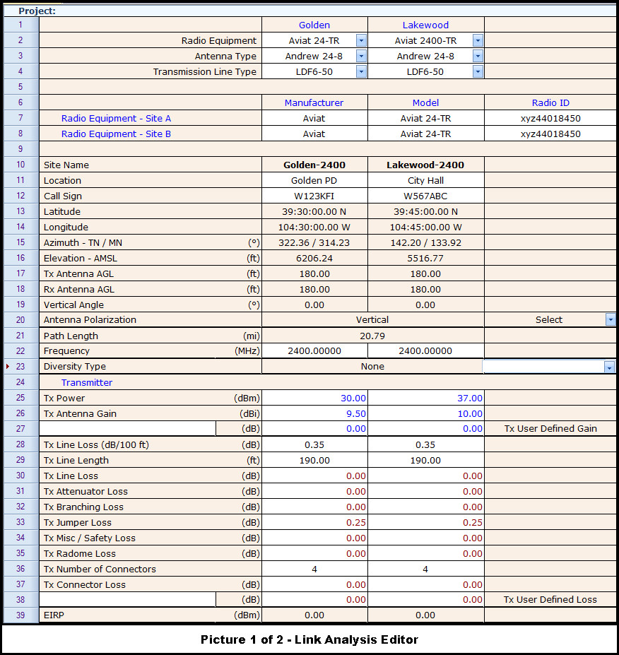
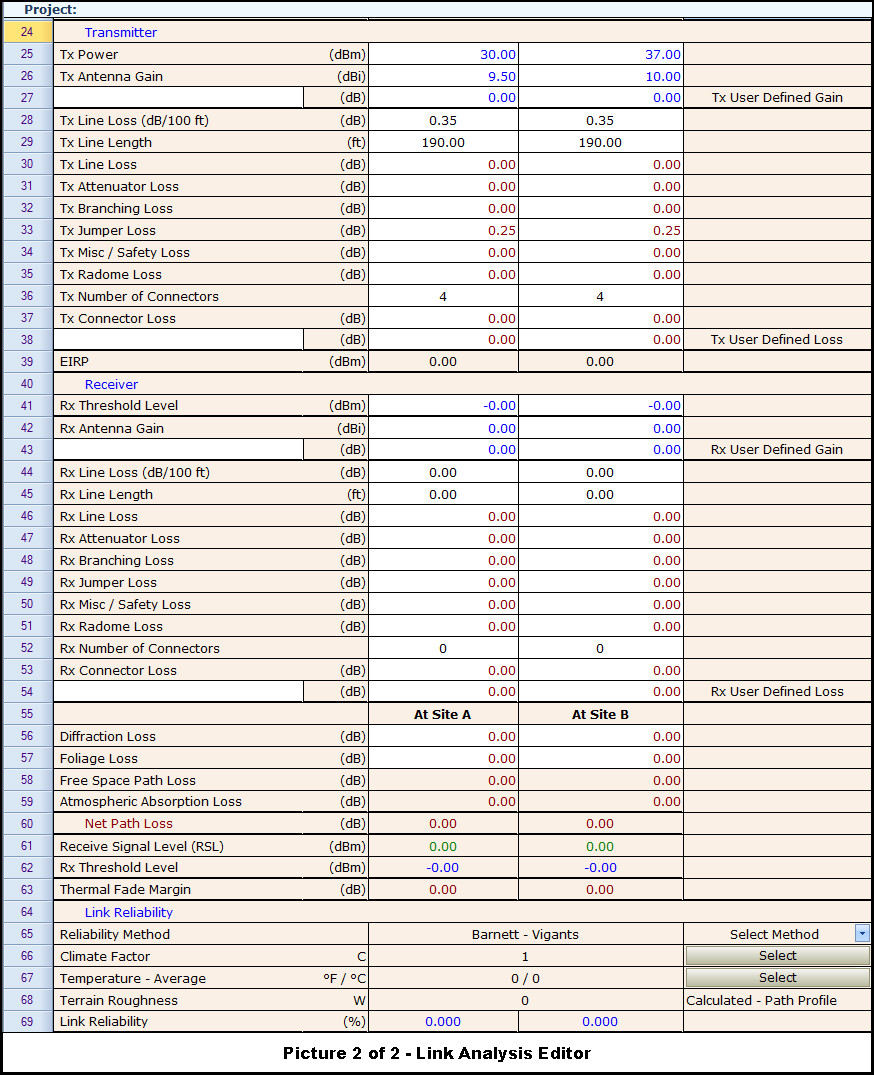
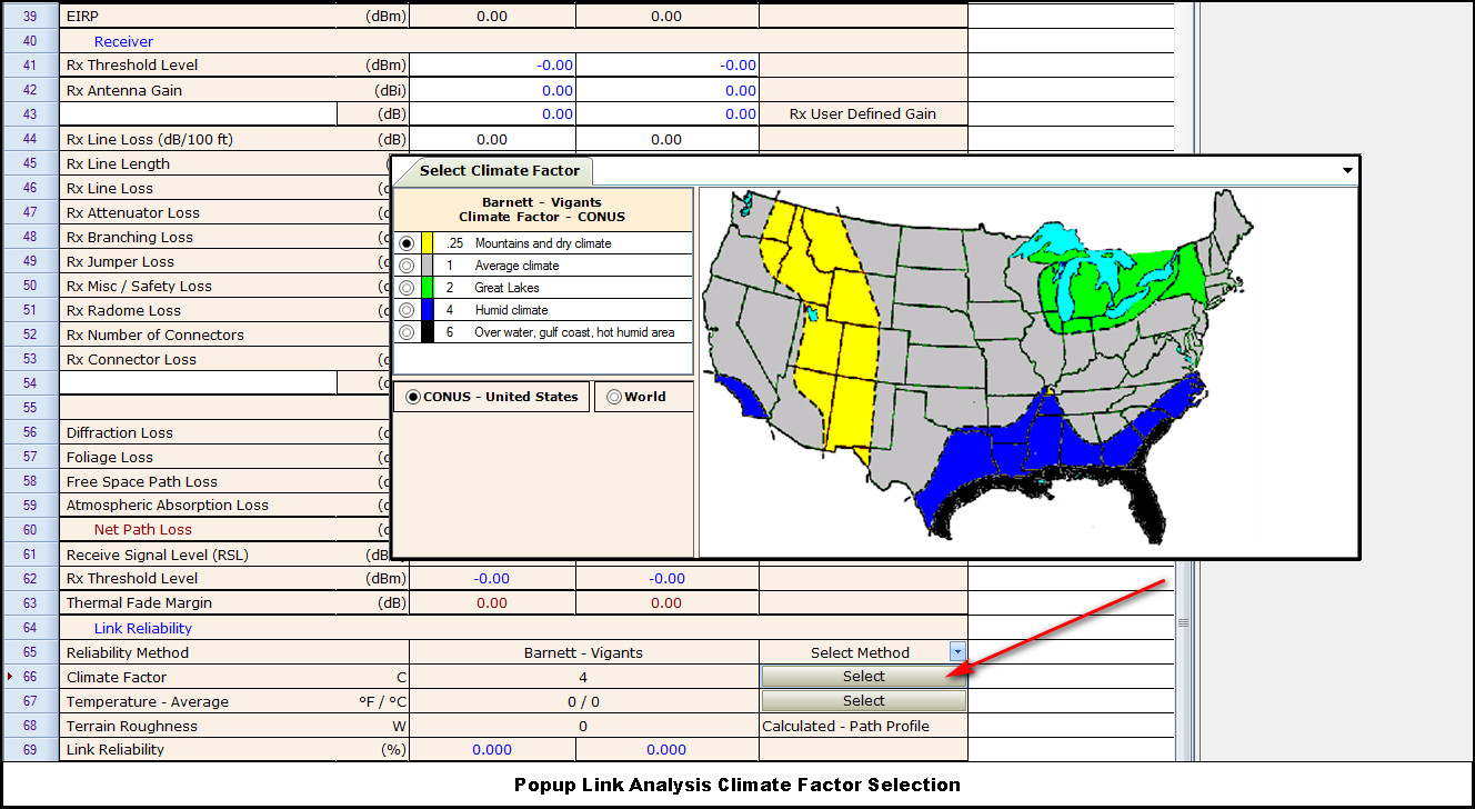
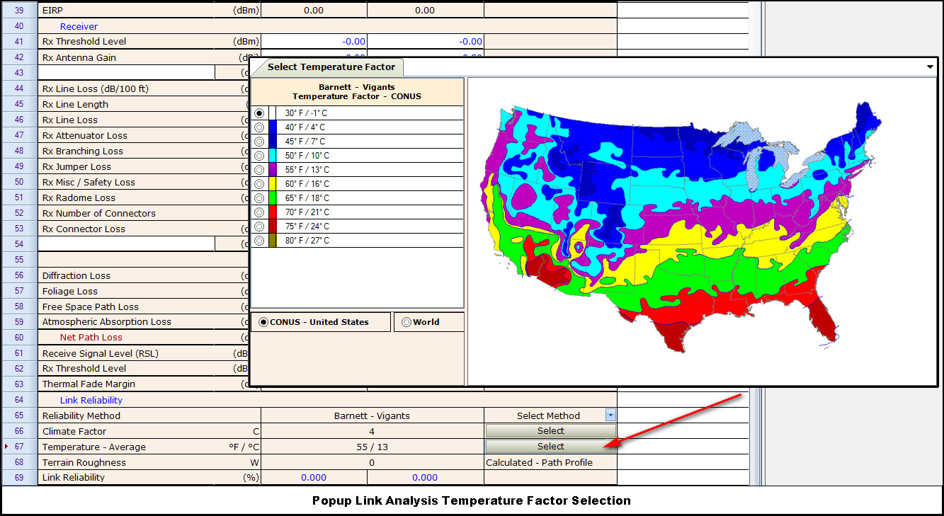
Microwave Path AnalysisThe Path Analysis editor imports the selected RadiantTxl equipment profiles, antenna types, and transmission line loss types.
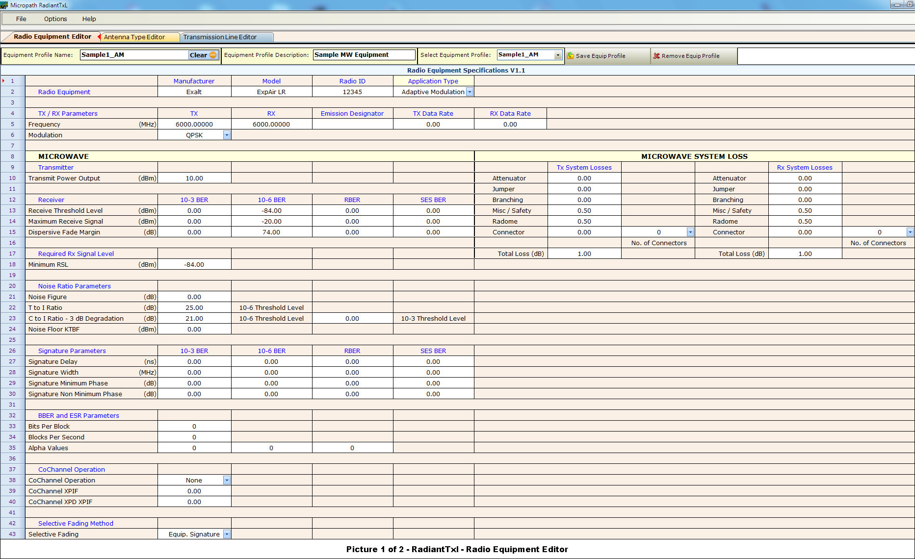
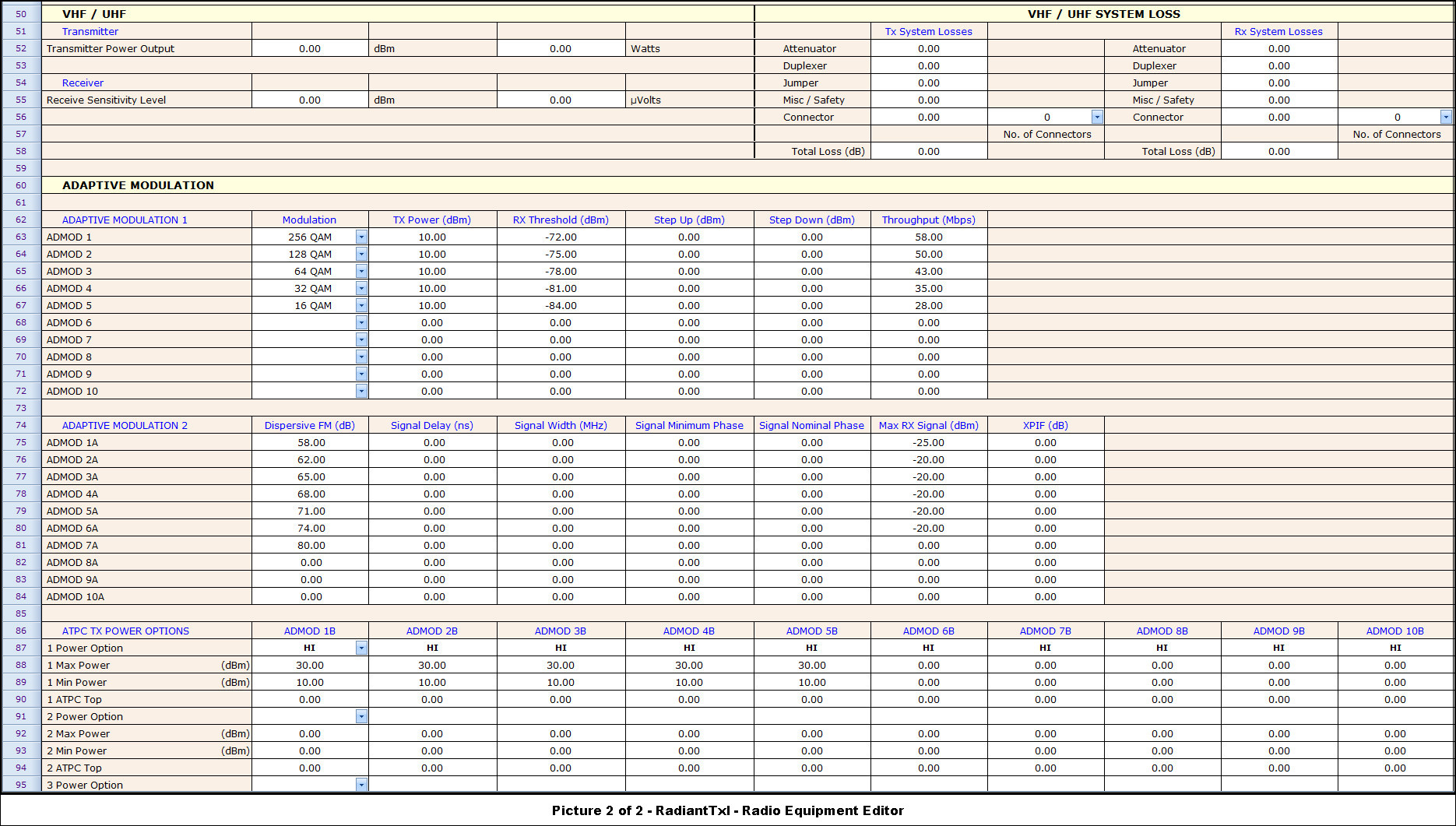
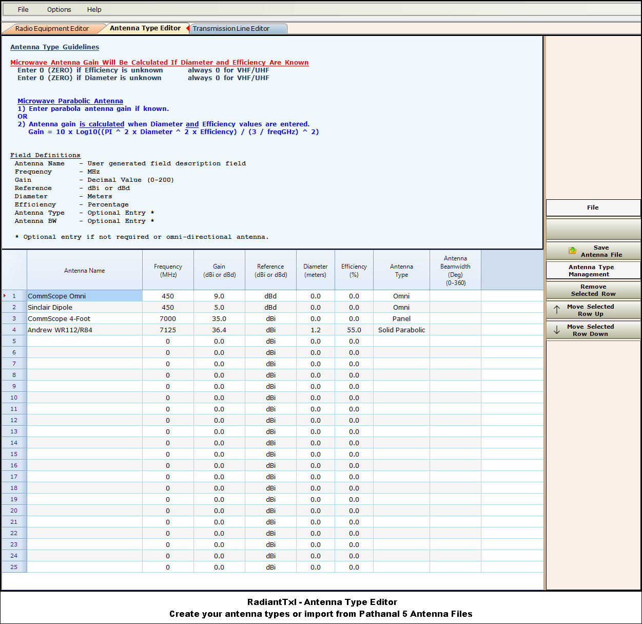
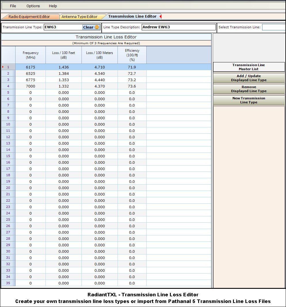
RadiantTxl - Radio Equipment Parameters, Antenna Types, And Transmission Line Loss TypesCreate and import your own equipment databases into the Microwave Path Analysis and VHF/UHF/SCADA Links.
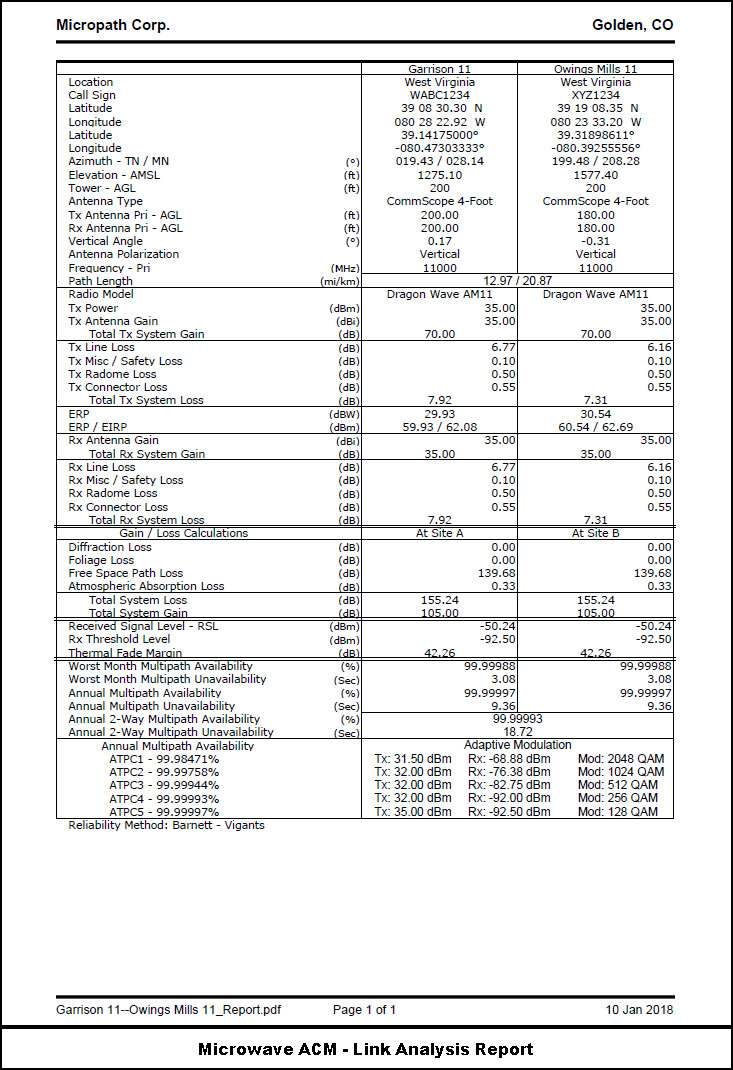
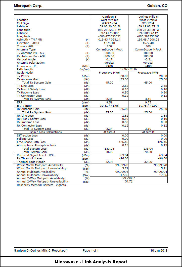
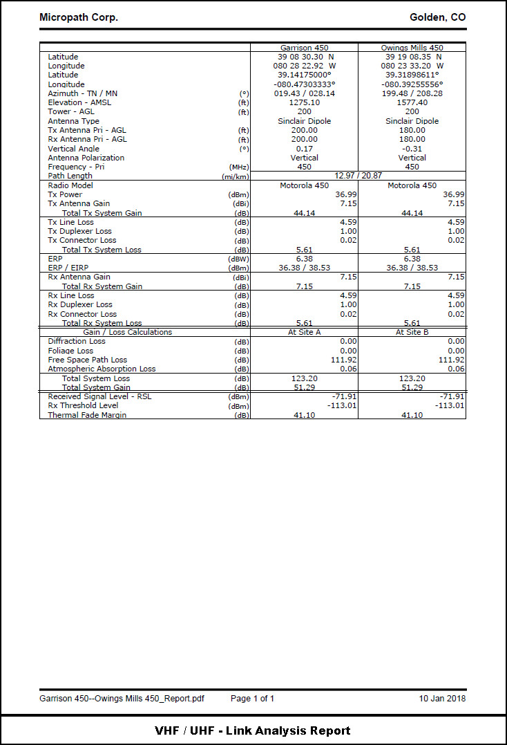
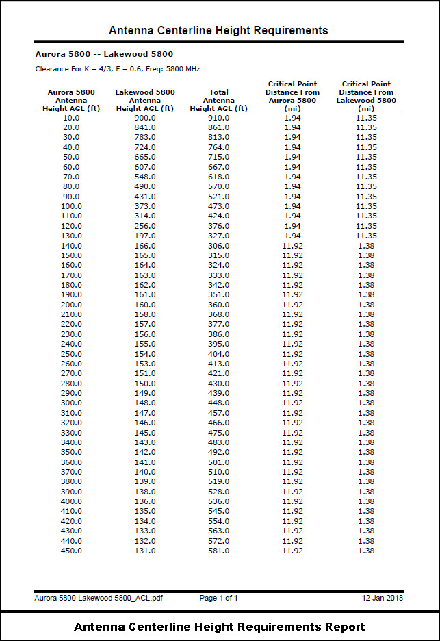
Microwave Path Analysis / Antenna Centerline ReportsPDF Reports for Microwave, VHF/UHF, and Adaptive Modulation.
|